

What Is the Pacific Coast Highway, Really?
The term "Pacific Coast Highway" gets used loosely, and it helps to know what you're actually signing up for. Technically, California State Route 1 (SR-1) is the official highway that most people mean when they say PCH. It runs along California's coast for roughly 656 miles, connecting the northern end near Leggett in Mendocino County all the way down to Dana Point in Orange County.
In practice, most road-trippers focus on the central and southern segments - typically anchored between San Francisco and Los Angeles - a stretch of around 400 miles that captures the legendary scenery people associate with California coastal driving: towering redcliffs, elephant seal colonies, artichoke farms, and surf towns.
SR-1 is a real highway, not a freeway. That means two lanes, sharp curves, no shoulders in some areas, and speed limits that rarely exceed 55 mph. Plan your daily mileage accordingly - what looks like a short distance on a map can take significantly longer to drive than expected.
SR-1 Closures Are a Real Possibility
The Big Sur segment of SR-1 has a well-documented history of significant closures due to landslides, erosion, and storm damage - some lasting months. Before your trip, always check current road status through the California Department of Transportation (Caltrans) rather than relying solely on navigation apps. Have an alternate inland route in mind, such as US-101, in case your preferred section is closed.
The Route From Start to Finish
Running roughly south to north, here's what the terrain actually looks like across the major segments:
San Diego to Los Angeles (about 130 miles)
This stretch is the most urban. You'll pass through beach communities like Oceanside, Carlsbad, and Malibu, with the highway weaving between beachfront neighborhoods and busy commercial corridors. Scenic, yes - but expect traffic, especially on weekends.
Los Angeles to San Luis Obispo (about 200 miles)
North of Malibu, the landscape opens up considerably. Point Mugu and the Santa Monica Mountains give way to wide, uncrowded beaches through Ventura and Santa Barbara. This mid-section is often underrated - rolling hills, agricultural flatlands, and some genuinely quiet coastline.
San Luis Obispo to Carmel (about 150 miles)
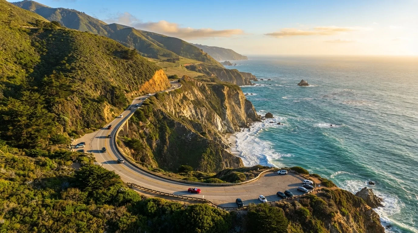
This is where it gets dramatic. The Big Sur coast - roughly 90 miles of cliffs, redwoods, and crashing surf - is the visual centerpiece of any PCH trip. The road here is narrow, winding, and genuinely thrilling. McWay Falls, Bixby Creek Bridge, and the Pfeiffer Big Sur State Park area are the landmarks everyone comes to see.
90 miles
Length of the Big Sur coastline segment
The Big Sur coast stretches roughly 90 miles and is widely considered the most dramatic section of the entire PCH route.
656 miles
Total length of California SR-1
California State Route 1 runs approximately 656 miles along the coast, though most road-trippers focus on a 400-mile central section.
3-5 days
Recommended minimum drive time
Most travel experts and experienced PCH drivers suggest a minimum of three to five days to cover the San Francisco to LA stretch comfortably.
Carmel to San Francisco (about 120 miles)
North of Carmel, SR-1 passes through Monterey and Santa Cruz before transitioning through Half Moon Bay toward the city. The scenery remains striking but feels more accessible - more towns, more services, more people.
Key Stops You Should Plan Around
Rather than trying to stop everywhere, anchor your itinerary around a handful of genuinely rewarding locations:
- Bixby Creek Bridge (Big Sur): One of the most photographed spots on the entire drive. Pull into the turnout north of the bridge for the classic view - don't stop on the bridge itself.
- McWay Falls (Julia Pfeiffer Burns State Park): An 80-foot waterfall that spills directly onto the beach. The short trail to the overlook takes about 10 minutes and is worth every second.
- Hearst Castle Viewpoint (San Simeon): Even if you don't tour the castle, the hilltop view from the road is memorable. The elephant seal rookery just south near Piedras Blancas is a genuine wildlife highlight.
- Santa Barbara: A full afternoon or overnight stop. The historic Spanish Mission, State Street, and the harbor make it one of the most livable-feeling towns on the route.
- Carmel-by-the-Sea: Famously charming, walkable, and a natural rest point before or after tackling Big Sur.
Book lodging in Big Sur several months in advance if you're traveling between May and September - inventory is genuinely limited in that corridor, and last-minute options are scarce.
Big Sur has very few accommodation options relative to the number of travelers it attracts, and popular dates sell out far earlier than most first-time visitors anticipate.
Check Caltrans QuickMap (quickmap.dot.ca.gov) the morning of any Big Sur transit - road closures here can be sudden and aren't always reflected quickly in navigation apps.
SR-1 through Big Sur has a documented history of landslide closures, some lasting weeks or months; having the official source bookmarked can save you hours of backtracking.
Timing, Weather, and Road Conditions
The PCH can be driven year-round, but conditions vary significantly by season and segment.
Spring (March-May) tends to offer green hillsides, wildflowers along the cliffs, and moderate temperatures - generally considered one of the best windows for the drive. Fall (September-November) brings clearer skies and lighter crowds than summer, making it another strong choice.
Summer is the most popular time, but coastal fog - locals call it "June Gloom" - can sock in views along the northern sections for days at a time. Campgrounds and turnouts fill quickly, and Big Sur can feel congested.
Winter brings the highest risk of road closures. Big Sur in particular is vulnerable to landslides and storm damage; SR-1 has closed for months at a time following major weather events. Always check Caltrans road condition reports before committing to that segment.
Don't Rely on Cell Navigation Alone
Cell service drops out for extended stretches through Big Sur and parts of the central coast. Navigation apps may also lag in reflecting recent road closures or construction detours. Download an offline map of the entire route before you leave, and carry a paper backup or screenshot of key segments. Getting caught without directions in an unfamiliar area after dark on a coastal highway is a situation worth avoiding.
Practical Tips for the Drive
A few logistics that make a real difference on this route:
- Drive direction matters: Heading north (Los Angeles to San Francisco) puts the ocean side of the road on your left - meaning passengers get the cliff-edge views. Heading south puts the driver closest to the scenic drop-offs, which can be distracting. Many travelers prefer the northbound direction for this reason.
- Fuel up in towns: There are long stretches in Big Sur with no gas stations. Fill up in Cambria heading north or in Carmel heading south. Don't assume the next town is close.
- Cell service is limited: Download offline maps before you go. Google Maps and Apple Maps both allow offline storage for specific regions.
- Parking at popular overlooks fills early: Arrive at major viewpoints before 10 a.m. or after 4 p.m. to avoid the worst congestion.
- Allow more time than you think: Most people underestimate the PCH by a full day. If your plan is to cover it in two days, consider building in a third.
The Pacific Coast Highway rewards curiosity over speed. The travelers who enjoy it most are the ones who budget extra time, stay flexible about where they stop, and resist the urge to check off every landmark. Let the road lead a little - that's what it's designed for.
The content on this site is for informational purposes only and is not a substitute for professional advice. Always consult a qualified professional for guidance specific to your situation.